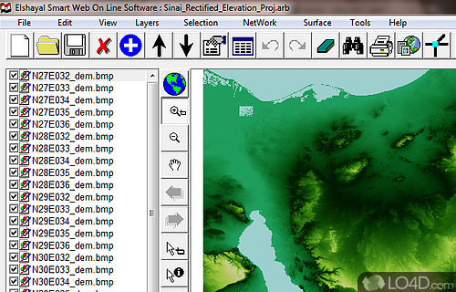
Comprehensive geographic information system software for creating, managing, analyzing and displaying spatial data.
Elshayal Smart GIS is a freeware map editor app and mapping tool developed by Elshayal Smart Web On Line Software for Windows. It's light on system resources, well-designed and advanced.
The download has been tested by an editor here on a PC and a list of features has been compiled; see below.
The first Arabian mobile GPS tracker and GIS map editor
Elshayal Smart is a comprehensive and efficient software for adding, viewing and editing multiple map image files.
This application provides support for data query builder, location query builder, build network, find shortest path, print map, save map image, copy map image to clipboard.
Features of Elshayal Smart GIS
- Building contour surface analysis.
- Building tin surface analysis.
- Calculating 2d and 3d areas and volumes.
- Convert GIS shape to AutoCAD DXF file and vise versa.
- Converting 2d to 3d surface analysis.
- Convert vector and raster layer coordinates system between utm and geographic lon-lat.
- Download and save google earth images as rectified images with world file format .Jgw.
- Makes goggle earth as a background of your gis geographic lon-lat map.
- Menu->tools->synchronize google earth with geographic lon-lat map.
- Save layout images with written lon and lat coordinates to help exporting them to AutoCAD.
Compatibility and License
Elshayal Smart GIS is provided under a freeware license on Windows from mapping with no restrictions on usage. Download and installation of this PC software is free and 24.07 is the latest version last time we checked.
What version of Windows can Elshayal Smart GIS run on?
Elshayal Smart GIS can be used on a computer running Windows 11 or Windows 10. Previous versions of the OS shouldn't be a problem with Windows 8 and Windows 7 having been tested. It comes in both 32-bit and 64-bit downloads.
Filed under:

